GIS24.net
Geographic Information System
POI database from MEINWOMOmaps


Geographic Information System
POI database from MEINWOMOmaps
Kottes-Purk
/
ADDRESS
 Gemeinde Kottes-Purk
L8273
WeiterUrl : https:/ / de.wikipedia.org/ wiki/ Kottes-Purk
UrlLoad : https:/ / yes
WikiText : Kottes-Purk ist eine Marktgemeinde mit 1.610 Einwohnern im Bezirk Zwettl in Niederösterreich. Kottes-Purk liegt im Tal der Kleinen Krems im Waldviertel in Niederösterreich. Die Fläche der Marktgemeinde umfasst 58,6 Quadratkilometer. 38,68 Prozent der Fläche sind bewaldet. Katastralgemeinden sind Bernhards, Dankholz, Doppl, Elsenreith, Ensberg, Ernst, Felles, Fohra, Gotthardschlag, Gschwendt, Günsles, Hörans, Heitzles, Kalkgrub, Koppenhof, Kottes, Leopolds, Münichreith, Pötzles, Pfaffenschlag, Purk, Reichpolds, Richterhof, Runds, Schoberhof, Singenreith, Teichmanns, Trittings, Voirans, Voitsau, Weikartschlag, Wernhies.
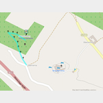
Click for interactive map
..
Pictures of the Poi and surroundings
Videos about the Poi and the surrounding area
.

.
Things to see in the area
Spar
[ click for more information ][ click for more information ]
Grossen Berg
[ click for more information ]Kreuzweg Oberranna
 The Way of the Cross leads past small chapels up to Calvary with the Crucifixion Chapel.
[ click for more information ]