GIS24.net
Geographic Information System
POI database from MEINWOMOmaps


Geographic Information System
POI database from MEINWOMOmaps
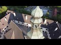
Enzenreith
/
ADDRESS
 2640 Enzenreith
Museumsweg
WeiterUrl : https:/ / de.wikipedia.org/ wiki/ Enzenreith
UrlLoad : https:/ / yes
WikiText : Enzenreith ist eine Gemeinde mit 1932 Einwohnern (Stand 2008) im Bezirk Neunkirchen in Niederösterreich. Enzenreith liegt im Industrieviertel auf 420 m über dem Meeresspiegel im Schwarzatal im südlichen Niederösterreich, südöstlich von Gloggnitz. Die Fläche der Gemeinde umfasst 9,19 Quadratkilometer. 44,75 Prozent der Fläche sind bewaldet. Katastralgemeinden sind Enzenreith, Hart, Hilzmannsdorf, Köttlach, Thürmannsdorf, Wörth.
Click for interactive map
..
Pictures of the Poi and surroundings
Videos about the Poi and the surrounding area
.
.
Things to see in the area
1789589_Beschreibung
[ click for more information ]
[ click for more information ]
Workshop at Lagerhaus possibly cheaper
[ click for more information ]
[ click for more information ]
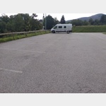
Wohnmobilparkplatz am Waldfriedhof
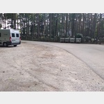 Gravel surface next to the road at the Waldfriedhof
is usable January - December
[ click for more information ]
Bahnhof
Gloggnitz station the start of the Semmering railway, UNESCO World Heritage Site[ click for more information ]
Polizei
Police Gloggnitz[ click for more information ]
Allgemein
dr Windtrechtinger[ click for more information ]
TouristInfo
Municipal Office and Tourist Information[ click for more information ]
Apotheke
Pharmacy Gloggnitz[ click for more information ]
Parkplatz Naturbad Gloggnitz
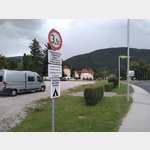 Parking at the Gloggnitz natural pool
 [ click for more information ]
Schloß Gloggnitz
 Parking directly outside the castle and at Gloggnitz Bahnwanderweg
 usable January - December
[ click for more information ]
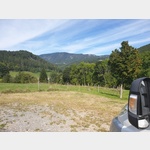
Parkplatz Infobox Gloggnitz
 Parking at the ÖBB info box above the Semmering base tunnel with a view of the (old) railway line and the tunnel portal construction site.
 [ click for more information ]
Kernstockwarte
The observation tower named after Ottokar Kernstock is located on the Wolfenkogel.[ click for more information ]