GIS24.net
Geographic Information System
POI database from MEINWOMOmaps


Geographic Information System
POI database from MEINWOMOmaps
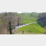
Othmarsingen
/
ADDRESS

WeiterUrl : https:/ / de.wikipedia.org/ wiki/ Othmarsingen
UrlLoad : https:/ / yes
WikiText : Othmarsingen ist eine Einwohnergemeinde im Bezirk Lenzburg im Schweizer Kanton Aargau. Sie liegt im Bünztal, knapp drei Kilometer östlich des Bezirkshauptorts. Das Dorf befindet sich in einer Talmulde beidseits der begradigten Bünz und ist auf drei Seiten von Wald umgeben. Es gibt zwei Siedlungsschwerpunkte, das Dorfzentrum am Westufer sowie das Gebiet um den Bahnhof. An der südöstlichen Gemeindegrenze liegt der Weiler Steinhof. Im Osten erhebt sich der Berg, ein Ausläufer des Wagenrains, der die natürliche Grenze zum Reusstal bildet. Nordwestlich des Dorfzentrums fliesst die Bünz durch einen Einschnitt einer flachen Endmoräne, die gegen Ende der Würmeiszeit beim Rückzug des Reussgletschers entstanden ist. Die Fläche des Gemeindegebiets beträgt 471 Hektaren, davon sind 193 Hektaren bewaldet und 107 Hektaren überbaut. Der höchste Punkt befindet sich auf 542 Metern auf dem Berg, die tiefste Stelle liegt auf 385 Metern an der Bünz.
Click for interactive map
..
Pictures of the place and surroundings
Videos about the Poi and the surrounding area
.


.
Interesting places in the area
Restaurant To the three stars
The restaurant space located on a large gravel parking lot to the restaurant three starsusable January - January
[ click for more information ]
Volg
with postal agency[ click for more information ]
Birchweiher
Er liegt am Rande eines Waldes etwas östlich des Dorfzentrums auf 410m[ click for more information ]
Maiengrünturm
The steel framework tower built in 1929 was extended in 1936 by 8 m to a height of 35 m.[ click for more information ]
Parkplatz Schloss Lenzburg
 There are three parking spaces directly at Lenzburg Castle (a small one on gravel, the other two asphalt), the largest is relatively level.
 [ click for more information ]
Raststätte Birrhard
Camper service on Autobahn 1.[ click for more information ]
Museum Burghalde
Burghalde is the only icon museum in Switzerland.[ click for more information ]
Dorfmuseum Birr
Local collections[ click for more information ]
Volg
with postal agency[ click for more information ]
Kraftreaktor
climbing and bouldering.[ click for more information ]
Dorfmuseum Niederlenz
Local history[ click for more information ]
Volg
with postal agency[ click for more information ]
Fünfweier
Er liegt südlich des Stadtzentrums etwa auf halben Weg zwischen Schloss Lenzburg und Esterliturm auf 435m[ click for more information ]
Büselweiher
Der südlich des Scherzer Dorfzentrums gelegene Weiher liegt auf 413m.[ click for more information ]
sonstiges
Ruedi Russel gas station[ click for more information ]
Volg
with postal agency[ click for more information ]
Esterliturm
The 48 m high concrete tower stands at a height of 557 m.[ click for more information ]