GIS24.net
Geographic Information System
POI database from MEINWOMOmaps


Geographic Information System
POI database from MEINWOMOmaps
Vordingborg
/
ADDRESS

WeiterUrl : https:/ / de.wikipedia.org/ wiki/ Vordingborg
UrlLoad : https:/ / yes
WikiText : Vorlage:Infobox Ort in Dänemark/Wartung/Fläche fehltVorlage:Infobox Ort in Dänemark/Wartung/Höhe fehlt Die dänische Hafenstadt Vordingborg (dt: Vordingburg) befindet sich im äußersten Süden von Seeland am Masnedsund. Hier führt die Storstrmbrücke nach Falster, eine kombinierte Straßen- und Eisenbahnbrücke, die Teil der Vogelfluglinie (Bahnverkehr) ist. Die alte Kommune war 176,4 km groß. Seit dem 1. Januar 2007 besteht die Kommune Vordingborg in der Region Sjlland aus den alten Kommunen Langebk, Mn, Prst und Vordingborg. Auf einer Fläche von nun insgesamt 621 ,km wohnen über 46.000 Einwohner. Vordingborg liegt etwa 17 ,km südwestlich von Prst, 28 ,km westlich von Stege, 29 ,km südlich von Nstved, 31 ,km nördlich von Nykbing Falster, 53 ,km nordöstlich von Rdby und 92 ,km Kilometer südwestlich von Kopenhagen.
Click for interactive map
..
Pictures of the Poi and surroundings
.
Things to see in the area
Museum Sydøstdamnark
[ click for more information ]Lilletorv
[ click for more information ]Vordingborg Slotruin
Castle ruins with a goose tower[ click for more information ]
Rema 1000
[ click for more information ]einkaufen
[ click for more information ]Aldi
[ click for more information ]Rådhusparkeringen
[ click for more information ]Autowaschanlage
[ click for more information ]Netto
[ click for more information ]Coop Kvickly Vordingborg Bagerafdeling
[ click for more information ]Vordingborg Havn
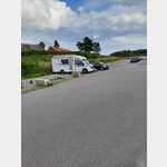 Parking space with space allocation in the port
open 1 May - 30 September
[ click for more information ]