GIS24.net
Geographic Information System
POI database from MEINWOMOmaps


Geographic Information System
POI database from MEINWOMOmaps
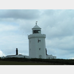
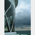
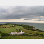
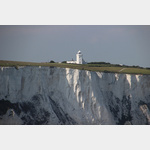
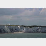
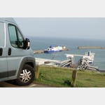
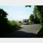
Leuchtturm South Foreland
Sight / lighthouse
Here is a marvel of Victorian engineering. A landmark of the white cliffs, the Victorian lighthouse was built to warn seafarers of quicksand. It was designed to guide all ships safely through the Strait of Dover. But it is also a place of innovation and science. As early as the 13th century, Brother Nicholas de Legh, who lived in a hermitage, hung his lantern on the rock to guide ships through the canal more safely. The current lighthouse was rebuilt in 1846. It worked until September 30, 1988. During its 142 years of service, the lighthouse has witnessed countless histories of the canal, including two world wars. You can follow these traces on a fantastic guided tour to this day. You can discover the rotating optics, which was installed in 1904, which still turns and uses a refined movement. You can also learn more about the works of Michael Faraday and his electricity and Guglielmo Marconi´s radio waves. The need for a light on the South Foreland lies at the Goodwin Sands, three miles offshore there is a 10 mile long sand bar also known as the Great Ship Swallower. At high tide the sand is constantly in motion. It can be seen at low tide. The constant movement of the sand makes this incredibly dangerous for ships. There are over 2000 recorded wrecks in the vicinity. The need for a light on the South Foreland lies at the Goodwin Sands, three miles offshore there is a 10 mile long sand bar also known as the Great Ship Swallower. At high tide the sand is constantly in motion. It can be seen at low tide. The constant movement of the sand makes this incredibly dangerous for ships. There are over 2000 recorded wrecks in the vicinity. The need for a light on the South Foreland lies at the Goodwin Sands, three miles offshore there is a 10 mile long sand bar also known as the Great Ship Swallower. At high tide the sand is constantly in motion. It can be seen at low tide. The constant movement of the sand makes this incredibly dangerous for ships. There are over 2000 recorded wrecks in the vicinity.
ADDRESS
 Dover
DoverSeaview Road
Click for interactive map
..
Pictures of the Poi and surroundings
.
Things to see in the area
The Pines Garden Tea Room & Museum
[ click for more information ]kleiner kostenpflichtiger Tagesparkplatz
[ click for more information ]Besucherzentrum an den White Cliffs/ National Trust
 There is a very nice visitor center with a café and a souvenir shop.
 [ click for more information ]
Parkplatz Granville Road 72
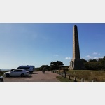 Car park at the DOVER PATROL memorial.
 [ click for more information ]
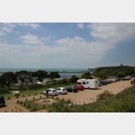
Parkplatz White Clif
 more suitable for shorter mobiles after the crossing.
 [ click for more information ]
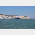
Faehre
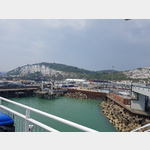 Dover - Dunkirk Dover - Calais Dover - Boulougne sur Mer Dover - Dieppe
[ click for more information ]
Parkplatz am Bahnhof
[ click for more information ]Martin Mill
[ click for more information ]Parkplatz Bleriot Memorial
Car park for RV´s up to 2.50m high for touring Dover Castle.[ click for more information ]
Parkplatz Undercliffe Rd
 Ideal place to stay overnight after a midnight ferry crossing.
 [ click for more information ]