GIS24.net
Geographic Information System
POI database from MEINWOMOmaps


Geographic Information System
POI database from MEINWOMOmaps
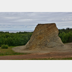
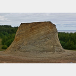
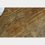
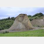
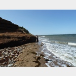
Der Bischofshut
Sight / Landscape
The bishop´s hat stands as a memorial in the ground of a former gravel pit where Moler was mined. This piece was left standing due to the particular ´knobbly´ ash and mole layers to show the original elevation of the landscape at that location. A moler is a sedimentary rock that consists mainly of microscopic diatoms. It emerges in the Limfjord area and is quarried on the island of Fur.
ADDRESS
 7884 Debel
Rødstensvej
Click for interactive map
..
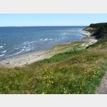
Pictures of the Poi and surroundings
.
Things to see in the area
Parkplatz
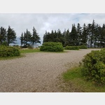 A car park with a view of the sea and large parking bays suitable for mobile homes up to 8 m.
 [ click for more information ]
Fur Fiskerihavn
[ click for more information ]TouristInfo
01/06/2015 - 15/09/2015 Saturday 09:00 - 17:00 01/06/2015 - 15/09/2015 Monday - Friday 10:00 - 16:00 16/09/2014 - 31 /05/2015 Saturday 09:00 - 17:00 16/09/2014 - 31/05/2015 Monday - Friday 10:00 - 16:00[ click for more information ]
Faehre
Car ferry from Branden to Fur and back.[ click for more information ]
Pulse Vig
[ click for more information ]Fur Havn
[ click for more information ]Faehre
Car ferry from Branden to Fur and back.[ click for more information ]
Parkenprivat
[ click for more information ]Livø Bredning
[ click for more information ]Der Knudeklinterne
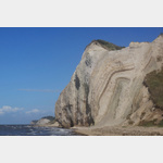 The spectacular cliffs on the north coast of the island of Fur offer incredibly good insights into the deformation of the earth´s crust.
 [ click for more information ]