GIS24.net
Geographic Information System
POI database from MEINWOMOmaps


Geographic Information System
POI database from MEINWOMOmaps
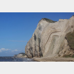
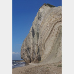
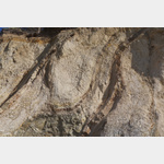
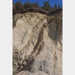
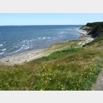
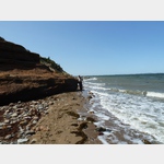
Der Knudeklinterne
Sight / Landscape
The spectacular cliffs on the north coast of the island of Fur offer incredibly good insights into the deformation of the earth´s crust. On the moler layers exposed by the water, which are interspersed with volcanic ash deposits, you can see very well how the clods and folds were pushed up. A moler is a sedimentary rock that consists mainly of microscopic diatoms. It emerges in the Limfjord area and is quarried on the island of Fur.
ADDRESS
 Debel
DebelOther category : Steilküste
Click for interactive map
..
Pictures of the Poi and surroundings
.
Things to see in the area
Fur Camping
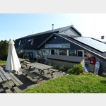 Camping on the island of Fur, the course is arranged in terraces
usable March - September
[ click for more information ]
Fur Fiskerihavn
[ click for more information ]Der Bischofshut
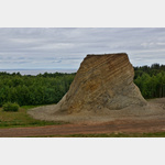 The bishop´s hat stands as a memorial in the ground of a former gravel pit where Moler was mined.
 [ click for more information ]