GIS24.net
Geographic Information System
POI database from MEINWOMOmaps


Geographic Information System
POI database from MEINWOMOmaps
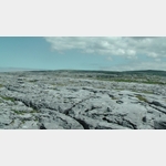
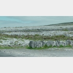
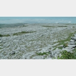
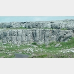
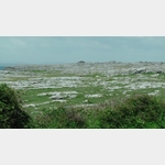
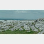
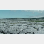
The Burren
Sight / Landscape
The Burren is a unique karst area covering 1,150 hectares.
It is one of the most fascinating karst landscapes in Europe.
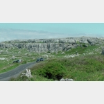
The area lies between the towns of Lisdoonvarna to the west, Gort to the east, Kilnaboy to the south and Ballyvaugham to the north.
The torn, bare, almost vegetation-free, grey-white limestone plateau is all the more eye-catching because of its rocky character in the otherwise evergreen Ireland.
In Irish, the area is called An Bhoireann Rocky Place.
In Edmund Ludlow´s memoirs of 1699, The Burren is said to be an area where there is not enough water to drown a man, not enough wood to hang him up, and not enough earth, to bury him.
27.11.2018: PoiBesuch: 09/2018 |
ADDRESS
 Ballyvaughan
Click for interactive map
..
Pictures of the Poi and surroundings
.
Things to see in the area
Ballyvaughan Service Ballyvaughan///EUR
[ click for more information ]Spar
[ click for more information ]Ballyvaughan Pier
[ click for more information ]Ballyvaughan Quay
[ click for more information ]Glenslende Castle
[ click for more information ]Poulnabrone Dolmen
Parking at the Poulnabrone Dolmen in the middle of the Burren.[ click for more information ]