GIS24.net
Geographic Information System
POI database from MEINWOMOmaps


Geographic Information System
POI database from MEINWOMOmaps
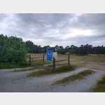
Trollskogen
Sight / Landscape
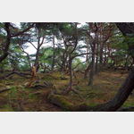
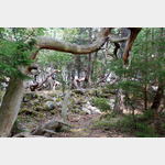
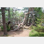
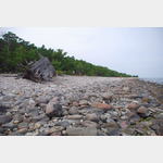
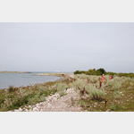
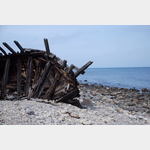
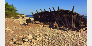
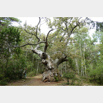
Trollskogen, translated as the magic forest, is a beautiful nature area on the northern tip of Öland. There are several circular routes of different lengths. View of the lighthouse. On the pebble beach is a wreck of an old German ship that got into distress and sank off Öland. In the Naturum on the Prakplatz you can get even more information about the area. Small snack on the square, at least in the summer months.
25.09.2016: PoiBesuc 06/2016 | The Park Ranger informed us friendly to the parking zone from 22-6: pointed midnight and wanted a relaxing stay.. The 2-hour walk to the forest railway was lovely
ADDRESS
380 75Nabbelundsvägen 1
Click for interactive map
..
Pictures of the Poi and surroundings
Routes and books with this POI
Rundreise:Süd-Mittel-Schweden
Große Skandinavientour
Südschweden
.
Things to see in the area
Parkplatz
 Day car park Directions: Drive to the Infocenter
[ click for more information ]
Grankullaviken
[ click for more information ]Böda Skogsjärnväg
Museum railway between Böda and Trollskogen[ click for more information ]
Långe Erik
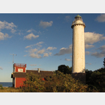 Långe Erik (Long Erik) is a 32 meter high lighthouse on the small island of Lilla Grundet, off the northern tip of Öland island.
 [ click for more information ]
Parkplatz
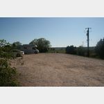 The place is good for one or two nights, in the high season the situation is not known.
 [ click for more information ]
Byxelkrok
A parking lot separated from the sea only by the road.[ click for more information ]