GIS24.net
Geographic Information System
POI database from MEINWOMOmaps


Geographic Information System
POI database from MEINWOMOmaps
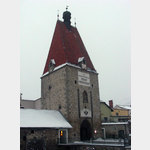
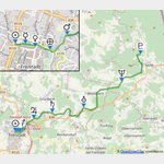
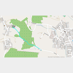
Planetenweg Freistadt
Sight / monument
The planet path illustrates our solar system with the nine planets.
Here, on the promenade in Freistadt is the sun 48. 51322, 14. 50288.
- Merkur N48. 51325, E14. 50405 Frauenteich
- Venus N48. 51297, E14. 50532 Exit at Böhmertor-Rosengarten
- Erde N48. 51271, E14. 50732 Rosengarten exit, Böckbrücke
- Mars N48. 51402, E14. 50958, Obere Hafnerzeile 20
- Jupiter N48. 52248, E14. 52241, Simbauer Schlag
- Saturn N48. 52676, E14. 54194, east of Schlag
- Uranus N48. 53027, E14. 57527 Church of St. Michael, Oberrauchenödt
- Neptun N48. 54843, E14. 61527 In front of the Lehner farmhouse, Viehberg
- Pluto N48. 56757, E14. 63513 Observatory Sandl
Both the size of the planetary models and the distances between them are on a scale of 1:369. 000, 000 shown. The path has a length of 16 km.
Detailed information is available at each station.
ADDRESS
 4240 Freistadt
Froschau 38
Click for interactive map
..
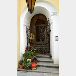
Pictures of the Poi and surroundings
.
Things to see in the area
Planetenweg Freistadt
 The planetary path illustrates our solar system with the nine planets.
 [ click for more information ]
Allgemeiner Parkplatz
[ click for more information ]Supermarkt
[ click for more information ]Sonstiges
[ click for more information ]Sonstiges
[ click for more information ]Autowaschanlage
[ click for more information ]McDonald
[ click for more information ]Billa
[ click for more information ]Schloss Freistadt
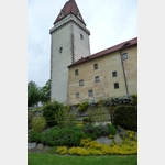 In 1363, Duke Rudolf IV commissioned the building of the palace.
 [ click for more information ]
Parkplatz am Stieranger
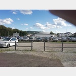 A large parking lot, parking and sleeping is allowed
is usable January - December
[ click for more information ]
Camping Freistadt
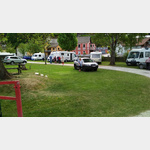 Small clean campsite in town location
is usable 1 January - 31 December
[ click for more information ]
Kreuzweg Freistadt
 The path was created around 1840.
 [ click for more information ]