GIS24.net
Geographic Information System
POI database from MEINWOMOmaps


Geographic Information System
POI database from MEINWOMOmaps
Seilpark Engelberg
Film / Zeigt einen Poi
Rope park experience on 6 different courses for adults and 3 courses for children from 4 years.
ADDRESS

Aufnahmejahr : 2016-08-04
length in minutes : 0.95
Click for interactive map
..
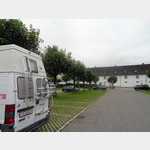
Pictures of the place and surroundings
.
Interesting places in the area
Tätschbachfall
Der Tätschbachfall ist einer der höchsten Wasserfälle der Schweiz und liegt in der Nähe von Engelberg OW.[ click for more information ]
Fürenbachfall
Fürenbachfall in der Gemeinde Engelberg Obwalden in der Nähe des Tätschbachfalles und der Bergstation der Bergbahn Fürenalp.[ click for more information ]
Biwak am Grassen
The hut is on the Tierberg between Titlis and Grasse and at the Wendenjoch between Engelberg and Gadmen at 2647 m above sea level.[ click for more information ]
Grassenbachfall
Es gibt den Grassenbachfall I mit einer Fallhöhe von 130m und den Grassenbachfall II mit 60m.[ click for more information ]
Alp Hobiel
Alp Hobiel is located on the terrace on the northern side of the valley at the very back of the Engelberg valley at 1,673 metres.[ click for more information ]
Parkplatz Kloster
 Parking at the Engelberg monastery.
 [ click for more information ]
Rugghubelhütte
At 2296 meters in the midst of an impressive mountain backdrop, high above Engelberg.[ click for more information ]
Sportingpark Engelberg
Ice skating, ice hockey, curling, cross-country skiing, tennis, badminton, speedminton, curling, fitness, climbing, sports field, swimming pool, restaurant[ click for more information ]
Sustlihütte
The Sustlihütte is located in the Meiental at 2257 m above sea level.[ click for more information ]
Brunnihütte
The Brunnihütte is 1860 m above sea level.[ click for more information ]
Härzlisee
Der Härzlisee liegt oberhalb der Gemeinde Engelberg im Gebiet Brunni im Kanton Obwalden.[ click for more information ]