GIS24.net
Geographic Information System
POI database from MEINWOMOmaps


Geographic Information System
POI database from MEINWOMOmaps
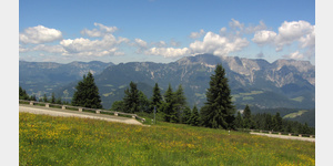
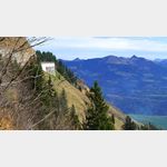
Kleiner Göll 1753 m
Alpine / mountaintop
ADDRESS

Click for interactive map
..
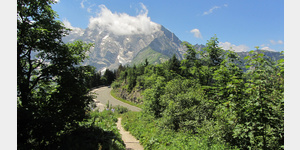
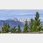
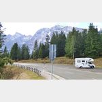
Pictures of the place and surroundings

.
Interesting places in the area
Schönbachkopf 1870 m
[ click for more information ]Vorderes Freieck 2142 m
[ click for more information ]Gollinger Wasserfall
[ click for more information ]SalzAlpenTour - Jochalm - Golling
SalzAlpenTour - Jochalm - Golling length: 11.31 km highest point: 1170 m lowest point: 505 m[ click for more information ]
Gasthof Bärenwirt
[ click for more information ]Grubenhorn 2230 m
[ click for more information ]Torrenerhof
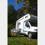
 A connected to a hotel and country inn camping
usable January - December
[ click for more information ]
Parkplatz Blumtaustrasse
 Parking lot at the beginning of the beautiful Bluntau valley, (must go for a walk or hike) in the summer is charged, otherwise free, is good for resting on the A 10, AB in the front area can be heard at night Arrival: from the A 10 to Golling then over the bridge to Beginning of the Bluntau Valley
[ click for more information ]
See
Bürgerausee Kuchl[ click for more information ]
Kuchl - Nesslangeralm - Kuchl
A circular hiking trail on the Salzalpensteig.[ click for more information ]
SalzAlpenSteig 12, Golling - Scheffau
SalzAlpenSteig The hiking trail leads over 233 km from Lake Chiemsee to the Dachstein.[ click for more information ]