GIS24.net
Geographic Information System
POI database from MEINWOMOmaps


Geographic Information System
POI database from MEINWOMOmaps
Arousa
/
ADDRESS
WeiterUrl : https:/ / de.wikipedia.org/ wiki/ Arousa
UrlLoad : https:/ / yes
WikiText : A Illa de Arousa (offizielle Bezeichnung in galicischer Sprache, spanisch La Isla de Arosa) ist eine auch als A ,Illa bekannte Insel im Zentrum der Ra de Arousa in der Provinz Pontevedra, Galicien (Spanien). Arousa hat eine Fläche von 7 ,km. Die knapp 5.000 ,Einwohner leben größtenteils in der Umgebung einer Landzunge, welche eine kleine Halbinsel, auf der sich die höchste Erhebung der Gemeinde befindet, mit dem Rest der Insel verbindet. Die Insel ist mit dem Kontinent über eine Brücke von fast zwei Kilometern Länge verbunden. Diese zählt zu den längsten Brücken Spaniens und kurbelte mit ihrer Fertigstellung im Jahr 1985 die lokale Wirtschaft an. Vorher mussten berfahrten und Transporte mit kleinen Dampfschiffen zu festgelegten Fahrtzeiten abgewickelt werden.
Click for interactive map
..
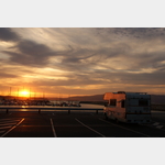
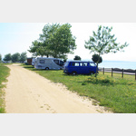
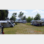
Pictures of the Poi and surroundings
.
Things to see in the area
Playa Riason
[ click for more information ]Bucht
Playa de Grandin[ click for more information ]
Area de Pontevedra
A parking lot by the sea, in season there is a bar on siteusable 1 January - 31 December
[ click for more information ]
Parkplatz PO-307
 Large parking lot directly at the bridge.
 [ click for more information ]
Bucht
Playa de Camaxe[ click for more information ]
Bucht
Playa Espineiro[ click for more information ]
Bucht
Playa de Labanqueira[ click for more information ]
Camping El Eden
A campsite by the seais open 1 June - 15 September
[ click for more information ]
CamperPark Isla de Arosa
 There is a private parking space right next to the Arosa Surf Camp.
 [ click for more information ]
Camping Salinas
A campsite on an island and only separated from the sea by a roadis open 15 May - 15 September
[ click for more information ]
Fkk
Unofficial nudist beach Nice beach with rocks but cold water.[ click for more information ]
Bucht
Playa Con da Mina[ click for more information ]
Bucht
Playa Mosqueiro[ click for more information ]