GIS24.net
Geographic Information System
POI database from MEINWOMOmaps


Geographic Information System
POI database from MEINWOMOmaps
Elafonisos
/
ADDRESS

WeiterUrl : https:/ / de.wikipedia.org/ wiki/ Elafonisos
UrlLoad : https:/ / yes
WikiText : f9f10f3 Elafonisos (griechisch ,ÎÎÎÏÏÎÎÏÎÏ (f. ,sg.)), ist eine kleine Insel zwischen dem Peloponnes und der griechischen Insel Kythira. Aufgrund ihrer Lage im Ionischen Meer wird sie zu den Ionischen Inseln gerechnet. Die Fläche der Insel beträgt etwa 19 km. Sie ist etwa 570 m vom Ort Pavlopetri auf dem Peloponnes entfernt. Zusammen mit einigen kleinen umliegenden Inselchen und einem rund 3 km fassenden Küstenstreifen am gegenüber liegenden Festland bildet sie die Landgemeinde Elafonisos in der Präfektur Lakonien. Die Gemeinde besteht verwaltungstechnisch aus dem Hauptort Elafonisos (625) und den Siedlungen Kapari (6 Einwohner im Jahr 2001), Kato Nisi (66), Lefki (35) und Pounda (13) auf dem Festland. Elafonisos wird durch die Meerenge von Elafonisos von Kythira getrennt, das etwa 4,5 Seemeilen südlich der Insel liegt.
Click for interactive map
..
Pictures of the Poi and surroundings
Videos about the Poi and the surrounding area
.
.
Things to see in the area
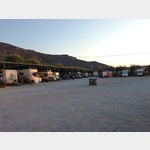
Badeparkplatz
Parking at the beach.[ click for more information ]
Várdhia
[ click for more information ]Leptós Kávos
π[ click for more information ]
Órmos Sarakíniko
[ click for more information ]Ákra Ayía María
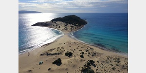
[ click for more information ]Simos Camping
 Great campsite on the dream beach
is open 20 April - 31 October
[ click for more information ]
Órmos Lévki
[ click for more information ]Parkplatz, kein Wohnmobilverbot
[ click for more information ]Órmos Frángo
[ click for more information ]Kávos Skálas
π[ click for more information ]
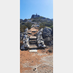
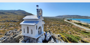
Kirche
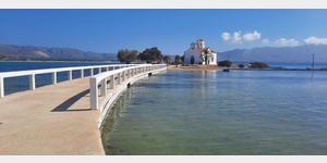 Very nicely located church right on the water and accessible via a jetty.
[ click for more information ]