GIS24.net
Système d´information géographique
Base de données POI de MEINWOMOmaps


Système d´information géographique
Base de données POI de MEINWOMOmaps
Laufamholzer Forst
/
ADRESSE
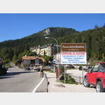
Malosco508
WeiterUrl : https:/ / de.wikipedia.org/ wiki/ Laufamholzer Forst
UrlLoad : https:/ / yes
WikiText : Der Laufamholzer Forst ist ein gemeindefreies Gebiet im mittelfränkischen Landkreis Nürnberger Land. Der 6,56 km große Staatsforst ist der südlich von Laufamholz und Schwaig gelegene Teil des Lorenzer Reichswaldes. Die Autobahn A3 bildet die nordöstliche Grenze, die Bahnstrecke NürnbergSchwandorf die nordwestliche Grenze. Der Hirschenkopf ist mit 380 m die höchste Erhebung im gemeindefreien Gebiet.
Cliquez pour une carte interactive
..
Photos du lieu et des environs
.
Lieux intéressants dans la région
Italien
[ cliquez pour plus d´informations ]Mendelpass, Italien| SS42 Bozen-Fondo 1363m 10%
[ cliquez pour plus d´informations ]Mendelbahn Bergstation
[ cliquez pour plus d´informations ]Cimitero
[ cliquez pour plus d´informations ]Eishöhlen
[ cliquez pour plus d´informations ]Parkplatz
Parking à Caldaro.[ cliquez pour plus d´informations ]
Haas
KEIN self-service Waschsalon[ cliquez pour plus d´informations ]
Eurospin
Supermarché Eurospin, V.[ cliquez pour plus d´informations ]
Friedhof
Cimetière, Via Cimitero 6, 39052 Caldaro[ cliquez pour plus d´informations ]
Schloss Wehrburg
Château de Hoheneppan[ cliquez pour plus d´informations ]