GIS24.net
Geographic Information System
POI database from MEINWOMOmaps


Geographic Information System
POI database from MEINWOMOmaps
Caravia
/
ADDRESS
ParresCarretera Les Arriondes/Arriondas - Colunga
WeiterUrl : https:/ / de.wikipedia.org/ wiki/ Caravia
UrlLoad : https:/ / yes
WikiText : Caravia ist eine spanische Gemeinde (in Asturien concejo, im übrigen Spanien municipio) in der autonomen Region Asturien. Die Bewohner von Caravia werden in der Landessprache caravianu bzw. caraviana genannt. Caravia ist die drittkleinste Gemeinde Asturiens. Seine Hauptorte sind Prado (asturisch Prau), Duesos und Duyos. Die Gemeinde liegt 68 km von Oviedo entfernt. El Fito im Süden der Gemeinde ist mit 631 ,m die höchste Erhebung. Im Norden grenzt die Gemeinde an das Meer (Golf von Bizkaya) und verfügt dort über die Strände La Beciella, El Arenal de Mors und La Espasa. Der mittlere Teil der Gemeinde bildet zusammen mit den Gemeinden Colunga, Piloa, Parres und Ribadesella die Sierra del Sueve.
Click for interactive map
..
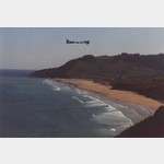
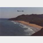
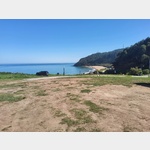
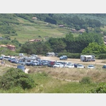
Pictures of the place and surroundings

.
Interesting places in the area
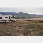
Parkplatz Recreatova El Fitu
 A parking lot with a spectacular view
open January - December
[ click for more information ]
Mirador del Fito
[ click for more information ]Camping Arenal de Moris
The campsite is not far from the A8open 1 June - 15 September
[ click for more information ]
Playa Arenal de Morís
 Slightly sloping parking with great views
usable January - December
[ click for more information ]
Playa Arenal de Moris
[ click for more information ]Playa de Beciella
[ click for more information ]ParkenAll
[ click for more information ]Playa de Viso
[ click for more information ]Cala de Berbes
[ click for more information ]Parroquia de Santa Marina Berbes
Parish of Santa Marina Berbes Ribadesella[ click for more information ]
Bucht
Playa de Espasa[ click for more information ]
Bucht
Playa de Isla[ click for more information ]
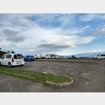
Parkplatz Ribadesella
 Nice place with a view of the beach, land and sea, someone comes once a day and collects five euros.
 [ click for more information ]