GIS24.net
Geographic Information System
POI database from MEINWOMOmaps


Geographic Information System
POI database from MEINWOMOmaps
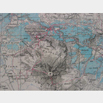
Santa Maria Val Müstair
/
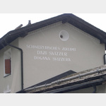
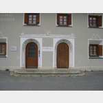
ADDRESS

WeiterUrl : https:/ / de.wikipedia.org/ wiki/ Santa Maria Val Müstair
UrlLoad : https:/ / yes
WikiText : Santa Maria Val Müstair (bis 1995 offiziell Santa Maria im Münstertal genannt) war bis zum 31. Dezember 2008 eine politische Gemeinde im Kreis Val Müstair im Bezirk Inn des Kantons Graubünden in der Schweiz. Per 1. Januar 2009 hat Santa Maria Val Müstair mit den übrigen Schweizer Gemeinden der Talschaft (Fuldera, Lü, Müstair, Tschierv und Valchava) zur Gemeinde Val Müstair fusioniert. Santa Maria war vor der Fusion die südlichste Gemeinde des Bezirks Inn. Der Ort liegt an der Kreuzung der Passstrassen über den Ofenpass und den Umbrailpass und grenzt an Südtirol. Der Ortskern von Sta. Maria liegt auf 1375 ,m ,ü. ,M. Der höchste Punkt des früheren Gemeindegebietes ist der Piz Umbrail mit 3033 ,m. Weiter zählen die Fraktionen Sielva, Pizzet, Pütschai, Craistas und Büglios zum früheren Gemeindegebiet.
Click for interactive map
..
Pictures of the Poi and surroundings
.
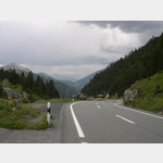
Things to see in the area
sonstiges
[ click for more information ]Volg
[ click for more information ]Campeggio Pe da Munt
Idyllic ACSI campsite on the edge of the forest with everything you needopen 21 May - 4 October
[ click for more information ]
Volg
[ click for more information ]Center da sandà Val Müstair
Phone: 081 851 61 00 Fax: 081 851 61 51[ click for more information ]
Raiffeisen Valchava
[ click for more information ]Cascada da Pisch
Waterfall in Val Müstair[ click for more information ]
sonstiges
[ click for more information ]Raiffeisen Engiadina Val Müstair
[ click for more information ]Bio Hof Puntetta
individual llama treks[ click for more information ]
Tauferspass
Switzerland-Italy| 28 /SS41 Santa Maria val Mustaire-Schluderns (Sluderno) 1259m 10%[ click for more information ]