GIS24.net
Geographic Information System
POI database from MEINWOMOmaps


Geographic Information System
POI database from MEINWOMOmaps
Philippsreut
/
ADDRESS
94158 PhilippsreutB 12
WeiterUrl : https:/ / de.wikipedia.org/ wiki/ Philippsreut
UrlLoad : https:/ / yes
WikiText : 734 (31. ,Dez. ,2008)[1] Philippsreut ist eine Gemeinde im niederbayerischen Landkreis Freyung-Grafenau, Mitglied der Verwaltungsgemeinschaft Hinterschmiding und staatlich anerkannter Erholungsort. Die Gemeinde liegt in der Region Donau-Wald im unteren Bayerischen Wald direkt an der Grenze zu Tschechien (CZ) an der Glasstraße 15 km nordöstlich der Kreisstadt Freyung. Das auf dem Gemeindegebiet liegende Skizentrum Mitterfirmiansreut rund um den 1.140 Meter hohen Almberg ist ein beliebtes Urlaubsziel. Durch die hohe Lage der Ortschaft auf einem freien Höhenrücken herrscht hier ein ziemlich rauhes Klima, welches besonders durch den kalten Nordostwind, von den Einheimischen Böhmwind genannt, beeinflusst wird.
Click for interactive map
..
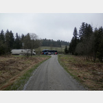
Pictures of the place and surroundings
.
Interesting places in the area
Goldsteig, Nordroute 20 Philippsreut Haidmuehle
The hiking trail leads through the Bavarian Forest and the Upper Palatinate Forest.[ click for more information ]
TouristInfo
[ click for more information ]Parkpaltz an der B12
Also suitable for large mobile homes.[ click for more information ]
Parkplatz an der B12
 Also suitable for large mobile homes.
 [ click for more information ]
Wasserscheide Donau Moldau
[ click for more information ]Vorderscheibling 997 m
[ click for more information ]B 12
[ click for more information ]Grandelberg 1010 m
[ click for more information ]Haidelturm
This 35 m high tower was built in 1999 from larch and Duglas fir wood.[ click for more information ]
Kalte Moldau
The Cold Moldau is formed west of Haidmühle through the confluence of the left Weberaubach and right Rothbach[ click for more information ]