GIS24.net
Geographic Information System
POI database from MEINWOMOmaps


Geographic Information System
POI database from MEINWOMOmaps
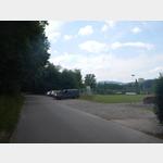
Lostorf
/
ADDRESS

WeiterUrl : https:/ / de.wikipedia.org/ wiki/ Lostorf
UrlLoad : https:/ / yes
WikiText : Lostorf ist eine politische Gemeinde im Bezirk Gösgen des Kantons Solothurn in der Schweiz. Lostorf liegt auf 451 ,m ,ü. ,M., 5 km nordöstlich der Stadt Olten (Luftlinie). Das ehemalige Bachzeilendorf erstreckt sich beidseits des Lostorfer Bachs in einer Talmulde am Jurasüdfuss, am nördlichen Rand der breiten Aareniederung im Solothurner Niederamt. Die Fläche des 13.3 km grossen Gemeindegebiets umfasst einen Abschnitt des Jurasüdhangs und weist eine grosse landschaftliche Vielfalt auf. Der südliche Gemeindeteil zeigt nur geringe Reliefunterschiede. Er umfasst einen kleinen Anteil der Aareniederung sowie die daran anschliessende Vorbergzone des Juras mit den Hügeln Balmis (483 ,m ,ü. ,M.), Eihübel (524 ,m ,ü. ,M.) und Buerfeld (bis 470 ,m ,ü. ,M.) mit sanft gegen Süden geneigten Hängen. Diese sind untergliedert durch die Talmulden des Lostorfer Baches und des Eibachs, welche hier in die Aareebene hinaustreten.
Click for interactive map
..
Pictures of the place and surroundings
Videos about the Poi and the surrounding area
.
.
Interesting places in the area
Dorfmuseum Lostorf
On three floors, visitors can get a great idea of how families used to live in the wonderfully renovated rooms.[ click for more information ]
Schloss Wartenfels
Several temporary exhibitions and cultural events are held at Schloss Wartenfels every year.[ click for more information ]
Falkensteinweiher
Der Falkensteinweiher liegt in der Gemeinde Lostorf auf 569 Metern im Ortsteil Bad Lostorf.[ click for more information ]
Volg
with postal agency[ click for more information ]
Kernkraftwerk Gösgen
During the factory tour, you get into the middle of the engine house, find out how work is done in the control room and experience the cooling tower up close.[ click for more information ]
Caravan park Winznau
 Quiet parking at the football field
open January - December
[ click for more information ]
Schafmatt
Die Schafmatt ist ein Passübergang vom solothurnischen Rohr ins basellandschaftliche Oltingen.[ click for more information ]
Salhöhe
Er verbindet die Orte Kienberg (SO) und Erlinsbach (AG) auf einer Höhe von 787m.[ click for more information ]
Waldgasthaus Chalet Salhöhe
Restaurant at the Salhöhe pass[ click for more information ]
Kunstmuseum Olten
The museum opened in 1905 and today houses an important collection of modern and contemporary Swiss art.[ click for more information ]
Archäologisches Museum
It is the story of Ice Age hunters, Stone Age farmers, wealthy Celts, Roman townspeople and medieval craftsmen.[ click for more information ]
Haus der Fotografie
Today it is the location for internationally renowned photo exhibitions[ click for more information ]
Historisches Museum Olten
The Historical Museum Olten documents the history of the city of Olten and the canton of Solothurn with its collection, exhibition projects and events.[ click for more information ]
Swiss Prime Tower Bornwald
In 2014, the 9 m high viewing platform was built at a height of 463 m.[ click for more information ]