GIS24.net
Geographic Information System
POI database from MEINWOMOmaps


Geographic Information System
POI database from MEINWOMOmaps
Hittnau
/
ADDRESS

WeiterUrl : https:/ / de.wikipedia.org/ wiki/ Hittnau
UrlLoad : https:/ / yes
WikiText : Hittnau ist eine politische Gemeinde im Bezirk Pfäffikon des Kantons Zürich in der Schweiz. Zu der Gemeinde gehören die Ortschaften Ober- und Unterhittnau, Isikon, Hasel, Dürstelen, Schönau und Hofhalden. Blasonierung Hittnau liegt oberhalb des Pfäffikersees an Verbindungsstrasse zwischen dem Glattal und dem Tösstal. Der höchste Punkt der Gemeinde ist der Stoffel mit 928 ,m ,ü. ,M., den tiefsten Punkt hat die Gemeinde beim Tobelweiher auf 604 ,m ,ü. ,M.. Das Gemeindegebiet befindet sich grösstenteils an dessen westlichem Ausläufer. Von der Gemeindefläche dienen 50.3% der Landwirtschaft, 37.2% ist mit Wald bedeckt, 4.2% ist Verkehrsfläche und 7.6% Siedlungsgebiet, 0.4% sind Gewässer.
Click for interactive map
..
Pictures of the place and surroundings
Videos about the Poi and the surrounding area
.
.
Interesting places in the area
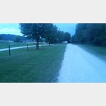
TCS Isikon
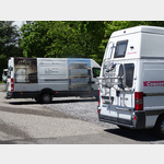 A parking lot in a nice location
usable 1 January - 31 December
[ click for more information ]
Luppmenweiher
Der Luppmenweiher ist ein Waldweiher südlich des Hittnauer Dorfzentrums auf einer Höhe von 700 Metern[ click for more information ]
Humbelweiher
Der Humbelweiher liegt auf dem Gemeindegebiet von Hittnau im Kanton Zürich auf einer Höhe von 692 Metern.[ click for more information ]
Camping Waldhof
The Camping Waldhof campsite is located in Oberhittnau, Switzerlandis usable 10 April - 30 September
[ click for more information ]
Alpaka-Zürich-Oberland
Alpaca trekking with snack or fondue[ click for more information ]
Chräbsiweiher
Der Chräbisweiher liegt im zürcherischen Pfäffikon auf 579 Metern.[ click for more information ]
Volg
with postal agency[ click for more information ]
Feuerwehrweiher
Der Feuerwehrweiher befindet sich in der Gemeinde Pfäffikon im Kanton Zürich auf 568 Metern.[ click for more information ]
Parkplatz Baumenstraße 40
 updates.
 [ click for more information ]
Museum
The museum houses a rich prehistoric collection and documents living and trade in the 18th and 19th centuries, homework and industrialization.[ click for more information ]
Bodenweiher
Der Bodenweiher liegt im zürcherischen Wila auf 589 Metern.[ click for more information ]
Hechtteich
Der Hechtteich liegt in der Stadt Wetzikon im Kanton Zürich[ click for more information ]
Müliweiher
Der Müliweiher ist ein kleiner Weiher auf dem Gebiet der Zürcher Gemeinde Wila auf 590m.[ click for more information ]
Museum Wetzikon
The permanent exhibitions are dedicated to the topics of pile dwelling and Romans.[ click for more information ]
Ortsmuseum Wila
The local museum presents the history of the community and organizes special exhibitions and events every year.[ click for more information ]
Fabrikweiher
Der Fabrikweiher befindet sich in der Stadt Wetzikon auf einer Höhe von 524 Metern[ click for more information ]
FBW-Museum
Many original vehicles from 1917.[ click for more information ]
Alti Sagi Stockrüti
The last sawmill in the Zurich Oberland powered by a water wheel is located in Stöckrüti near Wappenswil at an altitude of more than 800 meters.[ click for more information ]