GIS24.net
Geographic Information System
POI database from MEINWOMOmaps


Geographic Information System
POI database from MEINWOMOmaps
Bischofsmais
/
ADDRESS
94253 Bischofsmais, JägerwiesRitzmaiser Straße
WeiterUrl : https:/ / de.wikipedia.org/ wiki/ Bischofsmais
UrlLoad : https:/ / yes
WikiText : 3.188 (31. ,Dez. ,2008)[1] Bischofsmais ist eine Gemeinde im niederbayerischen Landkreis Regen und staatlich anerkannter Erholungsort. Bischofsmais liegt in der Region Donau-Wald inmitten des Bayerischen Waldes in einem kleinen, von bewaldeten Hügeln umgebenen Talkessel am Fuß der Berge Geißkopf, Einödriegel, Breitenauriegel und Teufelstisch. Die Ortschaft befindet sich etwa 9 ,km südlich der Kreisstadt Regen (Stadt), 17 ,km nördlich von Deggendorf sowie 19 ,km von Zwiesel entfernt. Die nächst gelegene Bahnstation liegt 8 ,km entfernt in Triefenried, dort hält die Bayerische Waldbahn und bietet Verbindungen mit Plattling und Bayerisch Eisenstein im zuverlässigen Stundentakt.
Click for interactive map
..
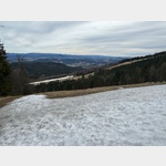
Pictures of the place and surroundings
Videos about the Poi and the surrounding area
.
.
Interesting places in the area
Wohnmpobilparkplatz am Rathaus
Nice parking behind the town hallopen 1 December - 31 December
[ click for more information ]
St. Hermann
[ click for more information ]Stadelberg 891 m
[ click for more information ]ParkenAll
[ click for more information ]Herrmannsschopf 824 m
[ click for more information ]Teufelstisch 901 m
[ click for more information ]Finkenrieder Berg 663 m
[ click for more information ]Geißkopfhütte
Serviced hut on the 1097 m high Geißkopf.[ click for more information ]
Geißkopfturm
 The 23 m high tower on the 1097 m high Geißkopf offers a magnificent view of the region.
[ click for more information ]
Goldsteig, Südroute 18 Landshuter Haus Lalling
The hiking trail leads through the Bavarian Forest and the Upper Palatinate Forest.[ click for more information ]
DE|Bayern|Deggendorf|94469|DEG19, 94469 Deggendorf, Deutschland
[ click for more information ]
[ click for more information ]