GIS24.net
Geographic Information System
POI database from MEINWOMOmaps


Geographic Information System
POI database from MEINWOMOmaps
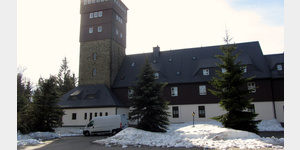
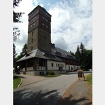
Sehmatal
/
ADDRESS
09465 SehmatalDorfstraße
WeiterUrl : https:/ / de.wikipedia.org/ wiki/ Sehmatal
UrlLoad : https:/ / yes
WikiText : Sehmatal ist eine Gemeinde im Erzgebirgskreis in Sachsen. Sie entstand 1999 durch den Zusammenschluss der Orte Neudorf, Cranzahl und Sehma. Die drei als Waldhufendörfer entstandenen Ortsteile befindet sich entlang der Sehma in einer Nord-Süd-Richtung. Am nördlichsten liegt Sehma, dann Cranzahl und am südlichsten Neudorf. Höchste Erhebungen sind der Bärenstein und der Kuhbrückenberg, beide mit einer Höhe von 898 m. Im Norden grenzt Sehmatal an Annaberg-Buchholz, im Osten an Königswalde und Bärenstein, im Süden an Oberwiesenthal und im Westen an Crottendorf.
Click for interactive map
..
Pictures of the place and surroundings
.
Interesting places in the area
1. Räuchermann Museum
[ click for more information ]Cranzahl
[ click for more information ]Fichtelbergbahn
[ click for more information ]nah und gut
[ click for more information ]Dr. Levin/ Dr. Uhlig Talstra. 4
[ click for more information ]Habichts-Berg 797 m
[ click for more information ]Lieben-Stein 756 m
[ click for more information ]Aussichtsturm Bärenstein
 The 30 m high tower stands on the 897 m high Bärenstein.
 [ click for more information ]
TouristInfo
Tourist Office Bärenstein[ click for more information ]
Parkplatz
Small parking lot at a hotel.[ click for more information ]