GIS24.net
Geographic Information System
POI database from MEINWOMOmaps


Geographic Information System
POI database from MEINWOMOmaps
Karlsbad
/
ADDRESS

WeiterUrl : https:/ / de.wikipedia.org/ wiki/ Karlsbad
UrlLoad : https:/ / yes
WikiText : Karlsbad liegt am Zusammenfluss der Eger (tschechisch Ohe) mit dem Flüsschen Tepl¡ (deutsch Tepl). Das Stadtzentrum mit der Verwaltung, dem unteren Bahnhof (doln n¡dra) und den Industriebetrieben liegt im flachen Egertal. Die Kuranlagen befinden sich im schmalen, südlich gelegenen Tal der Tepl¡. Westlich der Stadt befindet sich das Falkenauer Becken (Sokolovsk¡ p¡nev), das zweitgrößte tschechische Braunkohle-Tagebaugebiet mit mehreren Kraftwerken. Ortsteile von Karlsbad sind:
Click for interactive map
..
Pictures of the Poi and surroundings
.
Things to see in the area
dm
[ click for more information ]Billa
[ click for more information ]McDonal�ds Karlovy Vary T.G.Masaryka 560
[ click for more information ]Synagoge
[ click for more information ]lidl
[ click for more information ]Karlovy Vary
[ click for more information ]Wohnmobilstellplatz Karlovy Vary
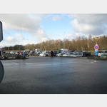 Large, gravel parking space
open 1 January - 31 December
[ click for more information ]
Diana
The tower was opened in 1914 on the 562 m high Vysina pratelstva, German friendship height.[ click for more information ]
Aussichtspunkt Karls IV.
Vyhlídka Karla IV.[ click for more information ]
Goethova vyhlidka
English: Goethe-Aussicht 1898, the tower cannot currently be entered due to dilapidation.[ click for more information ]
Doubska hora
On the 609 m high Doubska hora, German: Aberg, the stone tower replaced an earlier wooden tower in 1904.[ click for more information ]